From Wikipedia, the free encyclopedia
No higher resolution available.
Summary
Licensing
This image was taken from the
Geograph project collection. See
this photograph's page on the Geograph website for the photographer's contact details. The copyright on this image is owned by
Jeff Buck and is licensed for reuse under the
Creative Commons Attribution-ShareAlike 2.0 license.
You are free:
to share – to copy, distribute and transmit the workto remix – to adapt the work
Under the following conditions:
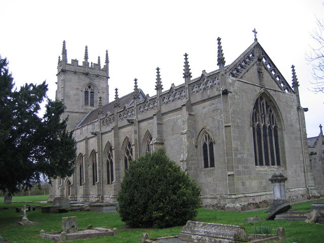
attribution – You must give appropriate credit, provide a link to the license, and indicate if changes were made. You may do so in any reasonable manner, but not in any way that suggests the licensor endorses you or your use.share alike – If you remix, transform, or build upon the material, you must distribute your contributions under the same or compatible license as the original. https://creativecommons.org/licenses/by-sa/2.0 CC BY-SA 2.0 Creative Commons Attribution-Share Alike 2.0 true true English St. Mary Magdalene's Church, Battlefield.
creator<\/a>"}},"text\/plain":{"en":{"":"creator"}}},"{\"value\":{\"entity-type\":\"property\",\"numeric-id\":2699,\"id\":\"P2699\"},\"type\":\"wikibase-entityid\"}":{"text\/html":{"en":{"":"
URL<\/a>"}},"text\/plain":{"en":{"":"URL"}}},"{\"value\":\"https:\\\/\\\/www.geograph.org.uk\\\/profile\\\/12987\",\"type\":\"string\"}":{"text\/html":{"en":{"P2699":" https:\/\/www.geograph.org.uk\/profile\/12987<\/a>"}},"text\/plain":{"en":{"P2699":"https:\/\/www.geograph.org.uk\/profile\/12987"}}},"{\"value\":{\"entity-type\":\"property\",\"numeric-id\":2093,\"id\":\"P2093\"},\"type\":\"wikibase-entityid\"}":{"text\/html":{"en":{"":" author name string<\/a>"}},"text\/plain":{"en":{"":"author name string"}}},"{\"value\":\"Jeff Buck\",\"type\":\"string\"}":{"text\/html":{"en":{"P2093":"Jeff Buck"}},"text\/plain":{"en":{"P2093":"Jeff Buck"}}},"{\"value\":{\"entity-type\":\"property\",\"numeric-id\":3831,\"id\":\"P3831\"},\"type\":\"wikibase-entityid\"}":{"text\/html":{"en":{"":" object of statement has role<\/a>"}},"text\/plain":{"en":{"":"object of statement has role"}}},"{\"value\":{\"entity-type\":\"item\",\"numeric-id\":33231,\"id\":\"Q33231\"},\"type\":\"wikibase-entityid\"}":{"text\/html":{"en":{"P3831":" photographer<\/a>"}},"text\/plain":{"en":{"P3831":"photographer"}}}}" class="wbmi-entityview-statementsGroup wbmi-entityview-statementsGroup-P170 oo-ui-layout oo-ui-panelLayout oo-ui-panelLayout-framed"> source of file<\/a>"}},"text\/plain":{"en":{"":"source of file"}}},"{\"value\":{\"entity-type\":\"item\",\"numeric-id\":74228490,\"id\":\"Q74228490\"},\"type\":\"wikibase-entityid\"}":{"text\/html":{"en":{"P7482":"
file available on the internet<\/a>"}},"text\/plain":{"en":{"P7482":"file available on the internet"}}},"{\"value\":{\"entity-type\":\"property\",\"numeric-id\":973,\"id\":\"P973\"},\"type\":\"wikibase-entityid\"}":{"text\/html":{"en":{"":" described at URL<\/a>"}},"text\/plain":{"en":{"":"described at URL"}}},"{\"value\":\"https:\\\/\\\/www.geograph.org.uk\\\/photo\\\/383039\",\"type\":\"string\"}":{"text\/html":{"en":{"P973":" https:\/\/www.geograph.org.uk\/photo\/383039<\/a>"}},"text\/plain":{"en":{"P973":"https:\/\/www.geograph.org.uk\/photo\/383039"}}},"{\"value\":{\"entity-type\":\"property\",\"numeric-id\":137,\"id\":\"P137\"},\"type\":\"wikibase-entityid\"}":{"text\/html":{"en":{"":" operator<\/a>"}},"text\/plain":{"en":{"":"operator"}}},"{\"value\":{\"entity-type\":\"item\",\"numeric-id\":1503119,\"id\":\"Q1503119\"},\"type\":\"wikibase-entityid\"}":{"text\/html":{"en":{"P137":" Geograph Britain and Ireland<\/a>"}},"text\/plain":{"en":{"P137":"Geograph Britain and Ireland"}}},"{\"value\":{\"entity-type\":\"property\",\"numeric-id\":7384,\"id\":\"P7384\"},\"type\":\"wikibase-entityid\"}":{"text\/html":{"en":{"":" geograph.org.uk image ID<\/a>"}},"text\/plain":{"en":{"":"geograph.org.uk image ID"}}},"{\"value\":\"383039\",\"type\":\"string\"}":{"text\/html":{"en":{"P7384":" 383039<\/a>"}},"text\/plain":{"en":{"P7384":"383039"}}}}" class="wbmi-entityview-statementsGroup wbmi-entityview-statementsGroup-P7482 oo-ui-layout oo-ui-panelLayout oo-ui-panelLayout-framed"> inception<\/a>"}},"text\/plain":{"en":{"":"inception"}}},"{\"value\":{\"time\":\"+2007-03-16T00:00:00Z\",\"timezone\":0,\"before\":0,\"after\":0,\"precision\":11,\"calendarmodel\":\"http:\\\/\\\/www.wikidata.org\\\/entity\\\/Q1985727\"},\"type\":\"time\"}":{"text\/html":{"en":{"P571":"16 March 2007"}},"text\/plain":{"en":{"P571":"16 March 2007"}}}}" class="wbmi-entityview-statementsGroup wbmi-entityview-statementsGroup-P571 oo-ui-layout oo-ui-panelLayout oo-ui-panelLayout-framed">
coordinates of depicted place<\/a>"}},"text\/plain":{"en":{"":"coordinates of depicted place"}}},"{\"value\":{\"latitude\":52.75079,\"longitude\":-2.7241,\"altitude\":null,\"precision\":1.0e-5,\"globe\":\"http:\\\/\\\/www.wikidata.org\\\/entity\\\/Q2\"},\"type\":\"globecoordinate\"}":{"text\/html":{"en":{"P9149":"52\u00b045'2.84"N, 2\u00b043'26.76"W"}},"text\/plain":{"en":{"P9149":"52\u00b045'2.84\"N, 2\u00b043'26.76\"W"}}},"{\"value\":{\"entity-type\":\"property\",\"numeric-id\":7787,\"id\":\"P7787\"},\"type\":\"wikibase-entityid\"}":{"text\/html":{"en":{"":"
heading<\/a>"}},"text\/plain":{"en":{"":"heading"}}},"{\"value\":{\"amount\":\"+225\",\"unit\":\"http:\\\/\\\/www.wikidata.org\\\/entity\\\/Q28390\"},\"type\":\"quantity\"}":{"text\/html":{"en":{"P7787":"225 degree<\/span>"}},"text\/plain":{"en":{"P7787":"225 degree"}}}}" class="wbmi-entityview-statementsGroup wbmi-entityview-statementsGroup-P9149 oo-ui-layout oo-ui-panelLayout oo-ui-panelLayout-framed"> exposure time<\/a>"}},"text\/plain":{"en":{"":"exposure time"}}},"{\"value\":{\"amount\":\"+0.01666666666666666666\",\"unit\":\"http:\\\/\\\/www.wikidata.org\\\/entity\\\/Q11574\"},\"type\":\"quantity\"}":{"text\/html":{"en":{"P6757":"0.01666666666666666666
second<\/span>"}},"text\/plain":{"en":{"P6757":"0.01666666666666666666 second"}}}}" class="wbmi-entityview-statementsGroup wbmi-entityview-statementsGroup-P6757 oo-ui-layout oo-ui-panelLayout oo-ui-panelLayout-framed"> f-number<\/a>"}},"text\/plain":{"en":{"":"f-number"}}},"{\"value\":{\"amount\":\"+2.8\",\"unit\":\"1\"},\"type\":\"quantity\"}":{"text\/html":{"en":{"P6790":"2.8"}},"text\/plain":{"en":{"P6790":"2.8"}}}}" class="wbmi-entityview-statementsGroup wbmi-entityview-statementsGroup-P6790 oo-ui-layout oo-ui-panelLayout oo-ui-panelLayout-framed">
focal length<\/a>"}},"text\/plain":{"en":{"":"focal length"}}},"{\"value\":{\"amount\":\"+7.09375\",\"unit\":\"http:\\\/\\\/www.wikidata.org\\\/entity\\\/Q174789\"},\"type\":\"quantity\"}":{"text\/html":{"en":{"P2151":"7.09375
millimetre<\/span>"}},"text\/plain":{"en":{"P2151":"7.09375 millimetre"}}}}" class="wbmi-entityview-statementsGroup wbmi-entityview-statementsGroup-P2151 oo-ui-layout oo-ui-panelLayout oo-ui-panelLayout-framed"> media type<\/a>"}},"text\/plain":{"en":{"":"media type"}}},"{\"value\":\"image\\\/jpeg\",\"type\":\"string\"}":{"text\/html":{"en":{"P1163":"image\/jpeg"}},"text\/plain":{"en":{"P1163":"image\/jpeg"}}}}" class="wbmi-entityview-statementsGroup wbmi-entityview-statementsGroup-P1163 oo-ui-layout oo-ui-panelLayout oo-ui-panelLayout-framed">
File history
Click on a date/time to view the file as it appeared at that time.
Date/Time Thumbnail Dimensions User Comment current 20:08, 25 September 2010 640 × 480 (87 KB) File Upload Bot (Magnus Manske) == {{int:filedesc}} == {{Information |Description={{en|1=St. Mary Magdalene's Church, Battlefield., near to Battlefield, Shropshire, Great Britain. }} |Source=From [http://www.geograph.org.uk/photo/383039 geograph.org.uk]; transferred by [[User:Peter
File usage
The following 6 pages use this file:
Global file usage
The following other wikis use this file:
Usage on arz.wikipedia.org
Usage on cy.wikipedia.org
Usage on ru.wikipedia.org
Usage on vi.wikipedia.org
Usage on www.wikidata.org
This file contains additional information, probably added from the digital camera or scanner used to create or digitize it.
If the file has been modified from its original state, some details may not fully reflect the modified file.

_region:GB-GBN_heading:225.00&language=en)
